Houston, Texas State of West Virginia Western half of Turkey has medium resolution Spot Image satellite coverage for the whole country Areas of Australia also have new medium resolution Spot Image Metropolitan area of Chicago - excluding downtown Barcelona, Spain (Roy) - Barcelona unconfirmed - I see no new stuff compared to Google Maps Madrid, Spain Paris, France (Roy) Cannes, Antibes, Nice, St. Tropez, Orleans, and Monaco - French Riviera area (Martin) East Massachusetts (Roy) Westchester County and Albany, NY (Roy) Prague, Cz (Iñigo) Near Toronto, Quebec City, part of Ontario (including Belleville, Prince Edward County) - Canada (Iñigo, AKB, Philip) Palermo, Turin - Italy (Iñigo) Zurich, Switzerland (Iñigo) Greek Islands - including Kythnos, Gyaros, Syros, Polyaigos, Milos, and more Greece - Most of Greece now has at least medium resolution Spot Image Slovakia - entire country has new high res imagery (gulo) Cartagena (southwest), Spain (Martin) Manitoba (southeast), Canada (fengshui) Near Chiang Khong, Near Three Pagodas Pass, Thailand (Pete) Luang Prabang, Laos (Pete) Near Hanoi, Vietnam Phillipines - lots of areas - see comment by Eugene Villar Kobe, Kyoto, Japan (Munden) Southwest Montreal, Canada - lots of areas in southern Canada Northern border of Mexico - several GeoEye strips - e.g. see southwest of El Paso Lisbon, PortugalHab Ihr weitere Foto Updates entdeckt? PS: In Google Maps sind die Bilder noch nicht online.
Tag: 6. September 2008
 Google Mail 2.0, welches im Oktober letzten Jahres veröffentlicht wurde, war bisher nur für den Internet Explorer 7+ und Firefox 2+ sowie seit einigen Wochen auch für Opera verfügbar. Nun hat Google weitere Änderungen am Code von Google Mail vorgenommen und zeigt das neue Google Mail auch im immer noch weit verbreiteten Internet Explorer 6 an.
Wie es im Eintrag im Google Mail Blog heißt es, dass man ursprünglich Google Mail 2.0 nicht für den IE 6 veröffentlichen, da dieser Microsoft Browser nicht mehr sehr stabil mit modernen Webseiten umgehen kann, da er ja schon vor sieben Jahre veröffentlicht wurde. In den letzten Monaten haben einige Googler eng mit einige Entwicklern von Microsoft zusammengearbeitet und einige Bugs in der JavaScript Engine des Internet Explorers behoben.
Google musste aber auch Google Mail etwas an den Internet Explorer 6 anpassen. So wird zum Beispiel kein Schatten beim "Contact-Popup" angezeigt.
In den kommenden Wochen soll es bei allen Accounts freigeschalten werden.
» Google Mail Blog
Google Mail 2.0, welches im Oktober letzten Jahres veröffentlicht wurde, war bisher nur für den Internet Explorer 7+ und Firefox 2+ sowie seit einigen Wochen auch für Opera verfügbar. Nun hat Google weitere Änderungen am Code von Google Mail vorgenommen und zeigt das neue Google Mail auch im immer noch weit verbreiteten Internet Explorer 6 an.
Wie es im Eintrag im Google Mail Blog heißt es, dass man ursprünglich Google Mail 2.0 nicht für den IE 6 veröffentlichen, da dieser Microsoft Browser nicht mehr sehr stabil mit modernen Webseiten umgehen kann, da er ja schon vor sieben Jahre veröffentlicht wurde. In den letzten Monaten haben einige Googler eng mit einige Entwicklern von Microsoft zusammengearbeitet und einige Bugs in der JavaScript Engine des Internet Explorers behoben.
Google musste aber auch Google Mail etwas an den Internet Explorer 6 anpassen. So wird zum Beispiel kein Schatten beim "Contact-Popup" angezeigt.
In den kommenden Wochen soll es bei allen Accounts freigeschalten werden.
» Google Mail Blog
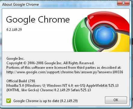 Welche Fehler ausgebessert wurden, ist nicht bekannt.
Die Sicherheitslücke, die mit Safari 3.1.2 gehoben wurde, besteht im Chrome weiter hin.
Google Chrome stürzt bei :% nicht mehr ab.
Das Update sollte automatisch von statten gehen.
[thx to: yildy]
Welche Fehler ausgebessert wurden, ist nicht bekannt.
Die Sicherheitslücke, die mit Safari 3.1.2 gehoben wurde, besteht im Chrome weiter hin.
Google Chrome stürzt bei :% nicht mehr ab.
Das Update sollte automatisch von statten gehen.
[thx to: yildy]
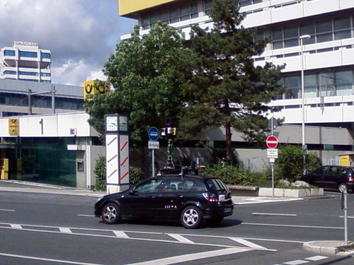
Gestern Nachmittag wurde das Google StreetView-Auto mal wieder in 2 weiteren deutschen Städten gesehen und fotografiert. Sowohl Wuppertal als auch Meißen (Sachsen) scheinen vom Start weg mit dabei zu sein. Wie immer handelt es sich dabei nicht wirklich um spektakuläre Fotos, aber als Beweis dafür dass das Auto wirklich unterwegs ist liefern wir sie trotzdem ;-) Bei dem obigen Foto handelt es sich um das Auto in Wuppertal - folgende 2 Fotos wurden in Meißen aufgenommen:
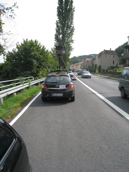
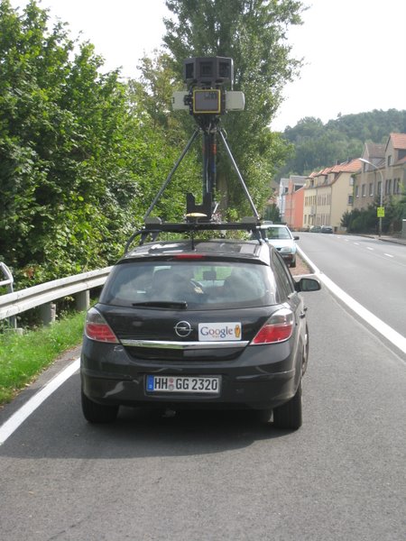
P.S. Irre ich mich, oder bricht da ein Streetview-Fahrer mal wieder die Verkehrsregeln? [thx to: Markus (Wuppertal) & Stefan (Meißen)]

Der rote Rahmen gehört natürlich nicht zum Banner Bei dem aktuellen Test kann man eigentlich schon garnicht mehr von einem Banner sprechen, sondern eher von einem per Script integrierten Text. Es gibt weder einen Rahmen um den Banner, noch wird irgendwo das Wort "Google-Anzeigen" oder "Werbung" eingeblendet. Der Banner ist also nicht als solcher Erkennbar. Aber schlimmer noch: Google hat automatisch die Farbe an das Design des Blogs angepasst, so dass der Banner komplett untergeht und Fehlklicks praktisch provoziert werden. Ich muss sagen, ich war noch nie ein Freund Von Googles Ad Units, aber das ist wirklich schon extrem. Dass die Anzeigen jetzt scheinbar automatisiert farblich angepasst werden ist okay, kann nur nützlich sein - aber dass das ganze nicht als Banner erkennbar ist geht meiner Meinung nach zu weit. Aber vielleicht ist es ja auch nur viel Aufregung um nichts und es hat sich einfach um einen Fehler seitens Google oder des Browsers gehandelt... [icedcream]